Water level and discharge modelling at the Lake Pfäffikon
Michel Kuhlmann, Dr. Uli Kuhlmann, 15 July 2020
Evaluation of different weir configurations using inverse hydraulic 1D modelling.
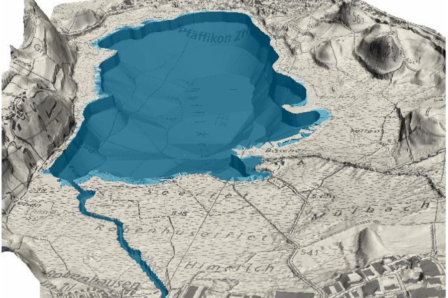
The weir at the outlet of the Lake Pfäffikon (Pfäffikersee, Canton of Zurich) controls the water level in the lake and therefore the discharge in the river Aabach.
As part of a revision of the weir system, it is planned to replace the existing, automated weir with a fixed elevation weir. The water level variation of the Lake Pfäffikon is of interest to many stakeholders, such as nature conservation, fishing, and local recreation. On the one hand, excessive or low water levels should be avoided in the most valuable swamps and wetlands in the Canton Zurich. On the other hand, the lake has to serve as a retention volume in the interest of flood protection. Therefore, it is important to know how a change in weir configurations affects the lake level under various hydrological conditions (e.g. flood and dry periods).
For this purpose, a hydrodynamic 1D model of the Lake Pfäffikon – including inflows and outflows – was created, which depicts the retention behavior of the lake and allows the simulation of the water level development during different hydrological conditions.
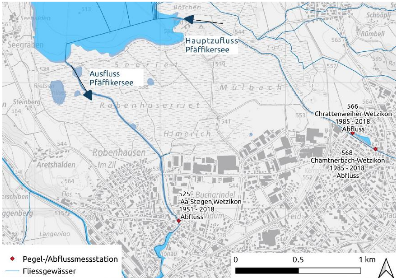
Subsequently, selected years with flood events (entire calendar year 1999, 2013) and dry weather years (2015, 2018) were calibrated using recorded level data. The cantonal monitoring stations (see Fig. 1) record the water level of the lake, the outflow in the Aabach, and the main inflow of the river Chämtnerbach. Based on this data, the unknown balance terms such as diffuse surface inflows, direct precipitation and evaporation were determined using inverse modelling.
Finally, the model is applied to the same, previously calibrated, years in order to simulate and assess the effects of changed weir parameters such as weir width, weir elevation, and residual water discharge on the course of the lake water level.
As a next step, the different stakeholders have to quantify goals regarding seasonal lake water level. The model then can be used to dimension and optimize the weir parameters.
Contact person
Michel Kuhlmann
MSc. Env. Science ETH
Project manager
| Tel.: | +41 (0) 44 288 81 82 |