Flood protection in Glarus
Michel Kuhlmann, 09. Nov. 2018
Analysis of extreme flood discharges at the Escherkanal - 1D & 2D runoff modelling
The canton of Glarus commissioned the consortium Scherrer AG, WSL, TK CONSULT AG to analyze the overload in case of extreme events at the Escherkanal.
The study was divided into 3 sub-projects: Scherrer AG developed more than 1'000 precipitation scenarios of varying duration, intensity and locality. The WSL transferred these scenarios into river influx curves using precipitation-runoff modelling.
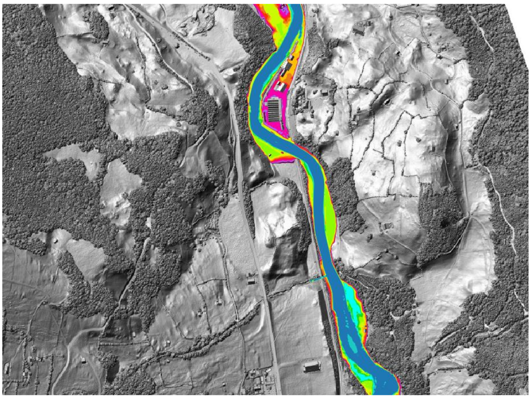
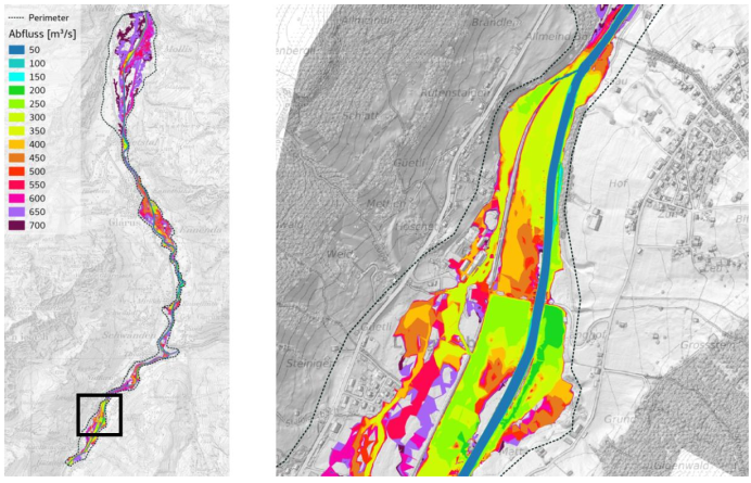
TK CONSULT AG carried out the subsequent hydrodynamic 1D/2D modelling on river section lengths of 24 km (1D) and 19 km (2D) including 10 power stations. The model was validated with respect to the 2005 flood event, which could be well reproduced. The validated model was used for a 2D vulnerability analysis as well as for an ensemble of 36 (1D) and 8 (2D) precipitation-runoff scenarios.
The conducted study provided information on the attenuation of the flood peak due to flood reservoirs along the Glarner Linth as well as knowledge on the maximum possible outflow at the Escherkanal entrance.
Contact person

Michel Kuhlmann
MSc. Env. Science ETH
Project manager
| Tel.: | +41 (0) 44 288 81 82 |