Extension of the St. Jakobsmatten groundwater wells for the water supply of Münchenstein
Michael Ballmer, 17. June 2020
Catchment area modelling using a numerical groundwater model
The municipality of Münchenstein is considering to withdraw its two existing groundwater wells Hofmatt and Ehinger and join the St. Jakobsmatten site. The latter is located in Münchenstein, but it has been only used by the neighbouring community of Birsfelden so far. The connection of Münchenstein would require the construction of a new groundwater well in addition to the three existing. In the article Grundwasserfassungen: strategische Planung und Standortwahl (Aqua & Gas, April 2020), the planning strategy of the municipality of Münchenstein was used as benchmark case.
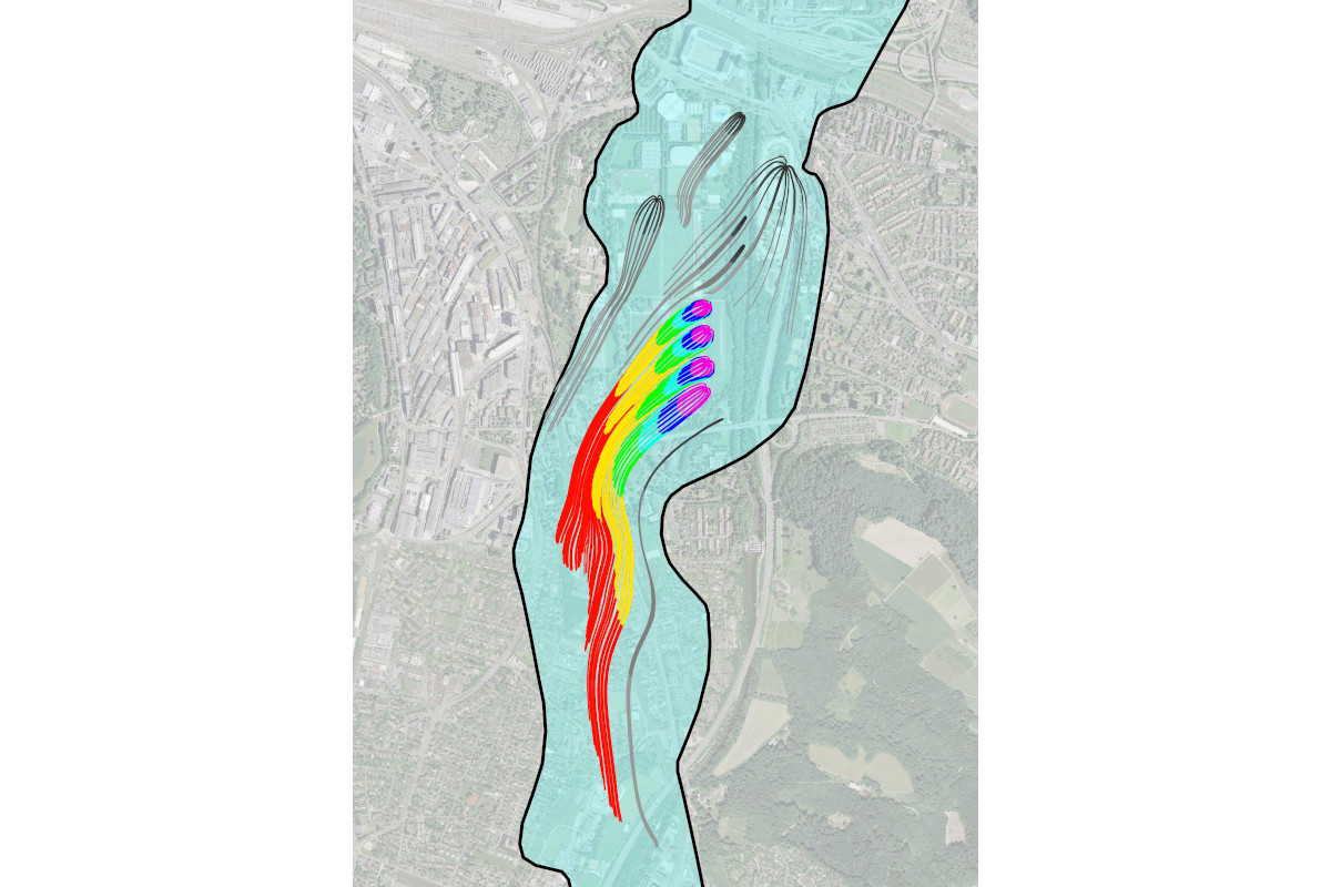
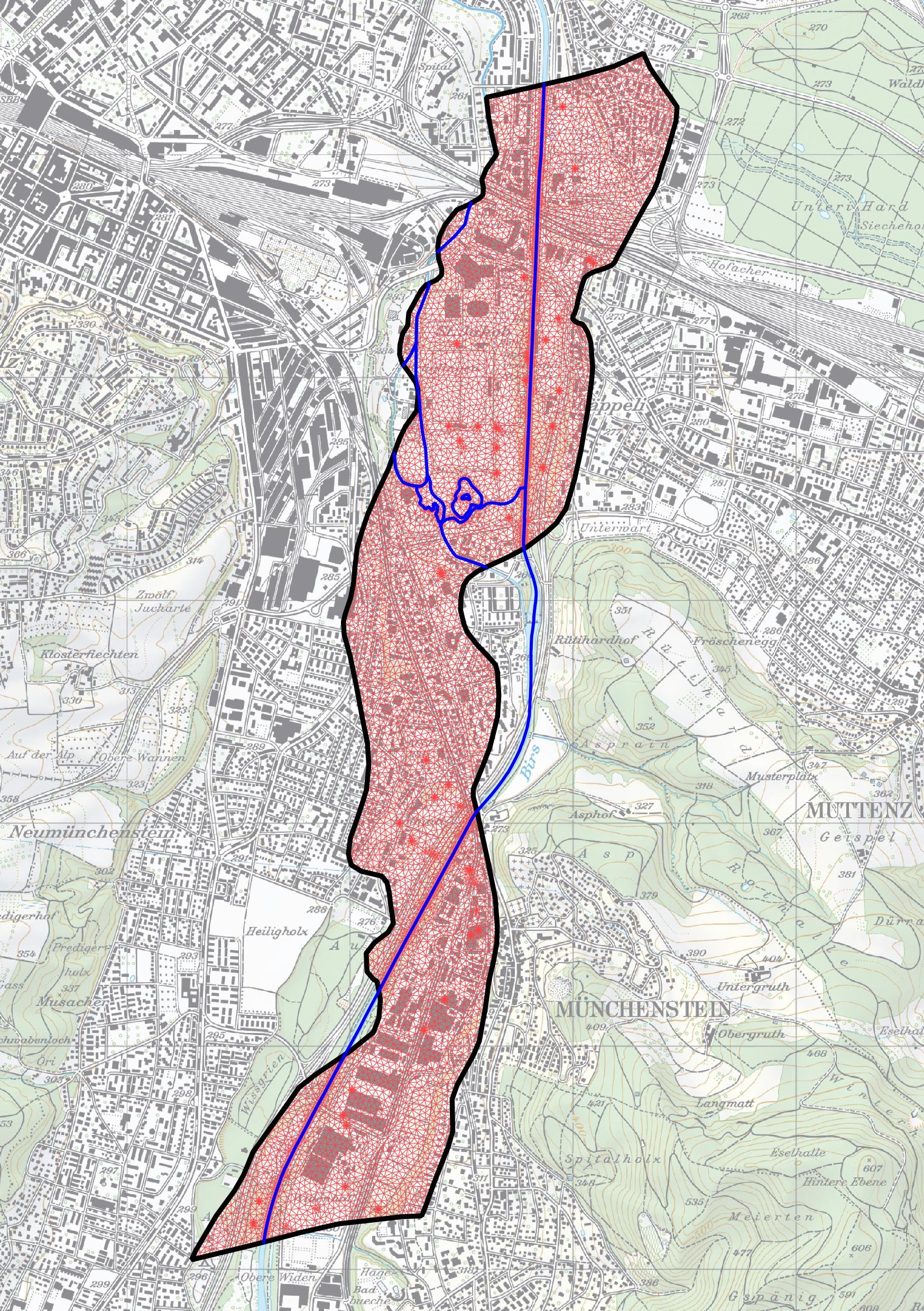
In addition to the hydrogeological investigations carried out by HOLINGER AG, a 2D groundwater model for the lower Birstal (TK CONSULT AG) was used as planning tool. The model was originally constructed for the municipality of Birsfelden during the revision of the groundwater protection zones of St. Jakobsmatten. Based on the groundwater measurements and the tracer test results, different model parameters as permeabilities, leakage values and porosities were calibrated in cooperation with the local hydrogeologists. The model spans a distance of around 5.5 km from Weidenhof (Arlesheim) in the south to Bethesda Hospital in the north (see figure).
The calibrated groundwater model enabled a detailed, cost-efficient simulation of the catchment areas for various hydrological and operational conditions (groundwater level, extraction capacity, well locations). Therefore, it can be used for various upcoming hydrogeological questions.
Contact person
Michael Ballmer
Dipl. Civil Eng. ETH
Project manager
| Tel.: | +41 (0) 44 288 81 84 |